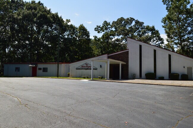
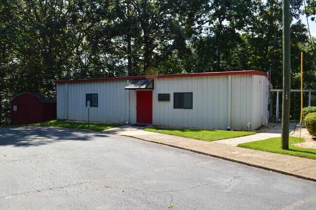
Property Record
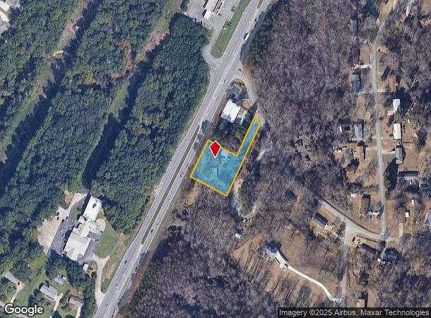
3579 Mcever Rd, Gainesville, GA 30504
NEARBY LISTINGS FOR SALE OR LEASE
Property Detail
3579 Mcever Rd
08-00032-00-084
MCEVER ROAD
Religious
Hall
X
Georgia
13139C0169G
32
0
0.95 AC
2025
Gainesville/Hall County
001406
Atlanta
2,462 SF
Gainesville, GA
DEMOGRAPHICS near 3579 Mcever Rd
1 mile
3 mile
5 mile
2024 Total Population
5,312
38,743
74,656
2029 Population
5,927
43,210
83,352
Pop Growth 2024-2029
+ 11.58%
+ 11.53%
+ 11.65%
Average Age
41
37
37
2024 Total Households
1,867
13,310
26,111
HH Growth 2024-2029
+ 11.57%
+ 11.60%
+ 11.68%
Median Household Inc
$65,610
$60,456
$59,596
Avg Household Size
2.80
2.80
2.70
2024 Avg HH Vehicles
2.00
2.00
2.00
Median Home Value
$279,763
$258,524
$271,595
Median Year Built
1996
1995
1992
Nearby Places
Map Layers
Map Styles
 Street
 Aerial
Transit
 Traffic
 Biking
Places
Listings with unknown addresses are not visible on the map
- Restaurants
- Banks
- Shops
- Fitness
- Groceries
PUBLIC TRANSPORTATION
COMMUTER RAIL
Gainesville Amtrak Station (Crescent - Amtrak)
Drive
Walk
Distance
Gainesville Amtrak Station (Crescent - Amtrak)
10 min
5.4 mi
Freight Ports
Georgia Ports - Savannah
Drive
Walk
Distance
Georgia Ports - Savannah
325 min
256.0 mi
SALE & LEASE HISTORY
LISTING DATE
SALE/LEASE

Oct 25, 2023
For Sale
Nearby Properties
Address
Land Use
TOTAL SIZE
Lot Size
Zoning
Address
Land Use
TOTAL SIZE
Lot Size
Zoning
157,050 SF
144.96 AC
N-B
Address
Land Use
TOTAL SIZE
Lot Size
Zoning
92,448 SF
24.25 AC
PUD
Address
Land Use
TOTAL SIZE
Lot Size
Zoning
760,440 SF
53.33 AC
L-I
Address
Land Use
TOTAL SIZE
Lot Size
Zoning
45,900 SF
6.99 AC
PRD
Address
Land Use
TOTAL SIZE
Lot Size
Zoning
342,720 SF
22.95 AC
PUD
Address
Land Use
TOTAL SIZE
Lot Size
Zoning
3,620 SF
20.20 AC
PUD
Address
Land Use
TOTAL SIZE
Lot Size
Zoning
41,471 SF
27.60 AC
G-B/R-1
Address
Land Use
TOTAL SIZE
Lot Size
Zoning
19,875 SF
19.76 AC
R-B
Address
Land Use
TOTAL SIZE
Lot Size
Zoning
277,684 SF
23.06 AC
L-I
Address
Land Use
TOTAL SIZE
Lot Size
Zoning
1,580 SF
15.85 AC
PUD
Address
Land Use
TOTAL SIZE
Lot Size
Zoning
132,557 SF
32.85 AC
O-I
Address
Land Use
TOTAL SIZE
Lot Size
Zoning
3,796 SF
18.09 AC
R-II
Address
Land Use
TOTAL SIZE
Lot Size
Zoning
258,372 SF
24.38 AC
L-I
Address
Land Use
TOTAL SIZE
Lot Size
Zoning
308,672 SF
41.22 AC
L-I
Address
Land Use
TOTAL SIZE
Lot Size
Zoning
2,204 SF
11.33 AC
PUD
Address
Land Use
TOTAL SIZE
Lot Size
Zoning
308,672 SF
41.22 AC
L-I
Address
Land Use
TOTAL SIZE
Lot Size
Zoning
2,396 SF
17.23 AC
R-II
Address
Land Use
TOTAL SIZE
Lot Size
Zoning
172,114 SF
43.32 AC
M-2
Address
Land Use
TOTAL SIZE
Lot Size
Zoning
192,177 SF
12.43 AC
PRD
Address
Land Use
TOTAL SIZE
Lot Size
Zoning
1,234 SF
1.29 AC
R-II
Address
Land Use
TOTAL SIZE
Lot Size
Zoning
102,996 SF
10.94 AC
L-I
Address
Land Use
TOTAL SIZE
Lot Size
Zoning
6,876 SF
10.64 AC
PRD
Address
Land Use
TOTAL SIZE
Lot Size
Zoning
141.54 AC
R-1
Address
Land Use
TOTAL SIZE
Lot Size
Zoning
1,392 SF
22.44 AC
PUD
Address
Land Use
TOTAL SIZE
Lot Size
Zoning
301,380 SF
16.76 AC
I-1
Address
Land Use
TOTAL SIZE
Lot Size
Zoning
25,638 SF
12.50 AC
R-II
Address
Land Use
TOTAL SIZE
Lot Size
Zoning
59,256 SF
7.27 AC
PRD
Address
Land Use
TOTAL SIZE
Lot Size
Zoning
199,610 SF
14.66 AC
L-I
Address
Land Use
TOTAL SIZE
Lot Size
Zoning
16,560 SF
9.62 AC
PRD
Address
Land Use
TOTAL SIZE
Lot Size
Zoning
45,986 SF
28.83 AC
L-I
The World's #1 Commercial Real Estate Marketplace
Connect with us
© 2026 CoStar Group
The information above has been obtained from sources believed reliable. While we do not doubt its accuracy we have not verified it and make no guarantee, warranty or representation about it. It is your responsibility to independently confirm its accuracy and completeness. Any projections, opinions, assumptions, or estimates used are for example only and do not represent the current or future performance of the property. The value of this transaction to you depends on tax and other factors which should be evaluated by your tax, financial, and legal advisors. You and your advisors should conduct a careful, independent investigation of the property to determine to your satisfaction the suitability of the property for your needs.